
Trump Sparks Global Outrage by Posting Map Labeling Strait of Hormuz as US Territory
1-Click Audio Report (Universal Voice)
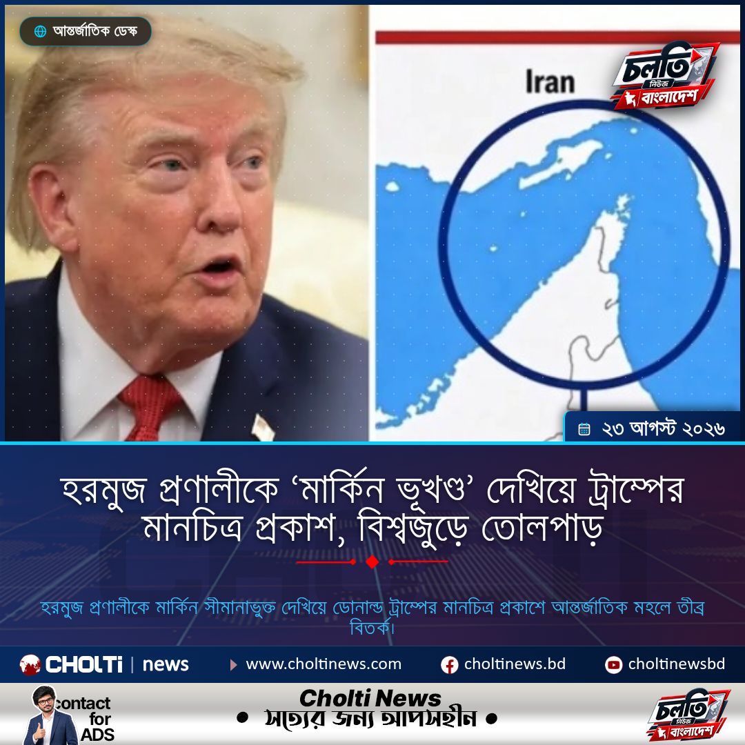
Former US President Donald Trump has sparked widespread controversy after sharing a map on social media that depicts the strategically vital Strait of Hormuz as United States territory. The incident has triggered intense debate and criticism among international diplomats and geopolitical analysts. Observers are questioning whether the mapping error was a mere oversight or a deliberate, provocative political statement regarding US influence in the Middle East.
- Donald Trump shared a map on social media depicting the strategically critical Strait of Hormuz as part of United States territory.
- Geopolitical analysts and international boundary experts quickly criticized the map for its severe historical and geographical inaccuracies.
- No official clarification or correction has been issued by Trump's campaign team or representatives following the public backlash.
National Investment & Sovereign Savings Bond Scheme
Secure high guaranteed yields backed by official treasury securities.
A controversial map shared by former US President Donald Trump on social media has triggered a fresh wave of global debate and scrutiny. The map in question depicts the Strait of Hormuz, one of the world's most sensitive and strategically vital maritime chokepoints, as part of United States territory. Almost immediately after the post went live, it drew sharp criticism and ridicule from international diplomats, scholars, and social media users alike. Labeling a crucial Middle Eastern energy transit route as American soil has raised serious questions about geographical literacy and the broader implications for US foreign policy.
Geographically, the Strait of Hormuz lies between Oman and Iran, linking the Persian Gulf with the Gulf of Oman and the Arabian Sea. Approximately one-fifth of the world's petroleum passes through this narrow waterway, making it a critical artery for the global economy and energy security. Historically, the strait has been a flashpoint of intense military and political tension, particularly between Washington and Tehran. Analysts are currently debating whether the inclusion of this international waterway in the US map was a technical graphic design error or a deliberate political statement.
Following the viral spread of the post, critics have condemned the act as highly unprofessional and irresponsible for a prominent political figure. Conversely, supporters of the former president have downplayed the incident, suggesting it was an oversight by the design team rather than a calculated geopolitical claim. Thus far, Trump's campaign office and official spokespersons have maintained silence, offering no formal clarification or retraction of the image. Boundary experts warn that such misleading representations can inadvertently escalate diplomatic tensions in already volatile regions.
From the editorial perspective of Cholti News, the social media activity of global leaders carries significant weight and cannot be dismissed as mere casual posting. Misrepresenting a highly contested international waterway like the Strait of Hormuz as US territory undermines the perceived credibility of American foreign policy. Such geographical inaccuracies from high-profile leaders risk projecting an image of disregard for international law and territorial sovereignty. Moving forward, it is imperative for political campaigns to exercise rigorous fact-checking to prevent diplomatic misunderstandings on the global stage.
“Social media posts by global leaders carry immense diplomatic weight and influence international relations. Depicting a highly sensitive region like the Strait of Hormuz as US territory reflects a lack of diplomatic rigor, potentially undermining global stability.”
Digital Innovation Summit 2026
Join South Asia's leading tech and AI entrepreneurship summit.